German Pavilion – Unbuilding Walls | 2018 Venice Architecture Biennale
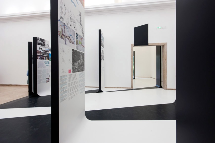
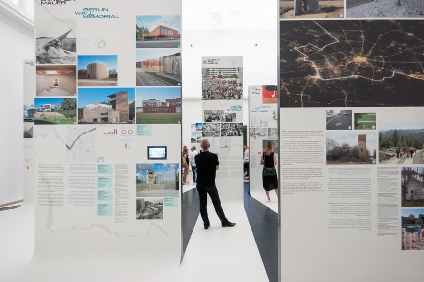
“Unbuilding Walls” exhibition, German Pavilion, Venice Architecture Biennale 2018, installation view; photo © Riccardo Bianchini /Inexhibit
German Pavilion – Unbuilding Walls | 2018 Venice Architecture Biennale
“Unbuilding Walls” is the title of the German Pavilion exhibition at the 2018 Venice Biennale of Architecture. Curated by GRAFT (led by Lars Krückeberg, Wolfram Putz, and Thomas Willemeint) and Marianne Birthler, the exhibition focuses on urban and architectural designs that address aspects of division and integration.
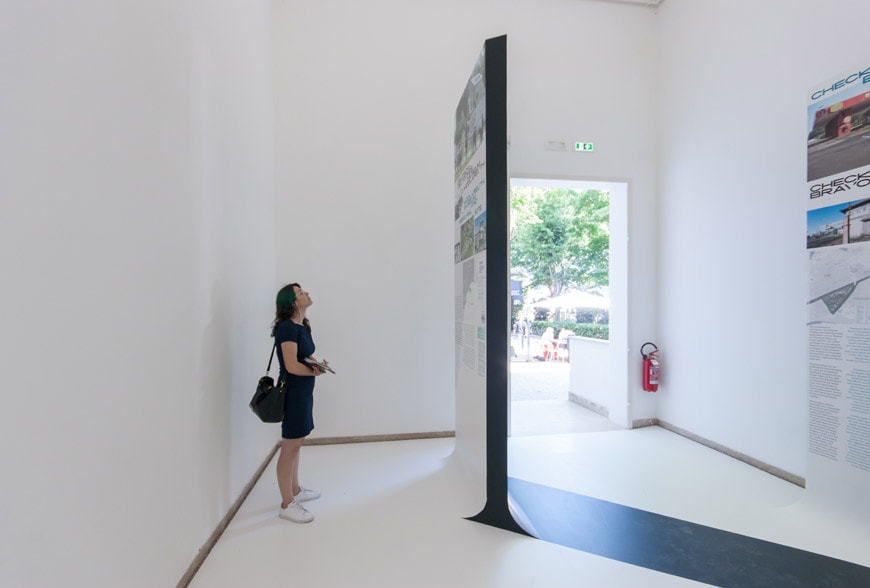
GRAFT, Unbuilding Walls” exhibition, German Pavilion, Venice Architecture Biennale 2018, installation views; photos © Inexhibit
Theme
In detail, Unbuilding Walls presents four exemplary projects for sites located on the former border strip between West and East Germany. Despite 28 years having passed since Germany’s reunification, many sites on, or close to, the former inner-German border are still “voids”, empty spaces in search of a new historical, social, and architectural identity. At the same time, such voids in the heart of Europe symbolically epitomize current cultural gaps, barriers, fences, and walls beyond Germany’s specific national perspective.

The curators of the German Pavilion at the 2018 Venice Architecture Biennale, left to right: Lars Krückeberg, Thomas Willemeit, Marianne Birthler, and Wolfram Putz; photo: Pablo Castagnola
Example Projects on view
Axel-Springer Campus, Berlin – Architect: OMA / Rem Koolhaas
The former death strip between Kreuzberg and Mitte is the site of the new campus building for Axel Springer designed by OMA. The design by Rem Koolhaas traces the course of the Wall diagonally through the building as a void, creating an expansive interior atrium that symbolizes not just the division of Berlin, but also the growing together of the city.
The new media campus augments the former newspaper headquarters that Axel Springer built from 1959–1965 as a political and symbolic statement directly next to the border with East Berlin. Although many newspapers moved out of the former newspaper district after the Wall was built, the Springer Verlag was the only media outlet to relocate its headquarters from Hamburg to Berlin. When the then Mayor Willy Brandt laid the foundation stone in 1959, however, no one knew that the 78-meter-high building would stand directly next to the Wall and the death strip. For the duration of the Cold War, large advertising was displayed high on the building, visible from both sides of the Wall.
The high-rise blocks of the Leipziger Straße complex, designed by the collective of Joachim Näther (urban design) and Werner Straßenmeier (architecture) and built in the direct vicinity of Springer’s high-rise headquarters on the east side of the Wall, were frequently interpreted as a direct reaction to the prominent visibility of the newspaper headquarters building from the east. Although Joachim Näther, then Head Architect of the GDR, disputed this throughout his lifetime, the high-rise residential blocks on the Leipziger Straße lessened the dominance of the Springer building and partially obscured the view of the illuminated headlines shining to the east from its roof.
The main axis of the 30-meter-high atrium of the new campus building is oriented towards the existing headquarters building. The terraced floors within provide space for 3500 members of staff and create an informal stage that opens onto the urban surroundings with exhibition areas and restaurants. In what was once the still void of the former death strip, the new digital newsroom will be one of the most active spots in the ever-changing city. As a block structure, the building adheres to the block plan of the surrounding Friedrichstadt district, but with twice the height, it points to the future increasing density of the center of Berlin. With this new building, OMA picks up the threads of architectural history and spins them onwards, weaving the history of the division of Germany into its narrative.
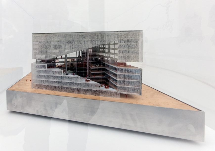
Model of the Axel-Springer Campus in Berlin designed by Rem Koolhaas / OMA; photo © Inexhibit

Axel-Springer Campus, image courtesy of OMA
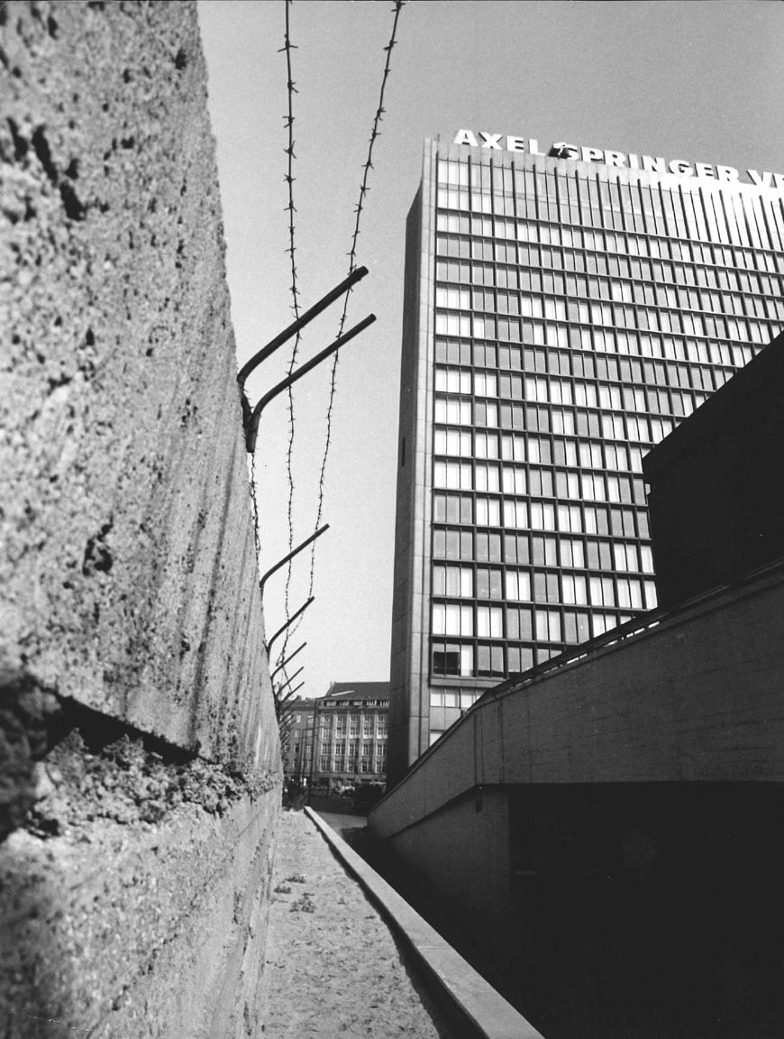
Axel-Springer-High-rise, photo: Axel Springer SE
Checkpoint Charlie, Berlin
Located at the intersection of the Zimmerstraße and the north-south axis of the Friedrichstraße, Checkpoint Charlie was the third crossing point after Checkpoint Alpha and Checkpoint Bravo between the American and Soviet sectors. It was used primarily by diplomats and people traveling from West to East Berlin. After the construction of the Wall and the tank confrontation shortly afterward in October 1961, it became, alongside the Brandenburg Gate, the most symbolically potent image of the Cold War.
On the East Berlin side, the demolition of the extensive border installations, watchtowers, and in this case three parallel lines of walls began in 1990. An empty urban space extending across almost five whole blocks resulted. Redevelopment plans for the Zimmerstraße, the former border strip, and the former East Berlin section of Checkpoint Charlie were soon proposed that followed the principle of “critical reconstruction” elaborated by the IBA in the West and now applied to East Berlin and the Wall zone. Following a series of architecture competitions for the American Business Center on the five blocks, only the three northernmost blocks were developed to designs by Philip Johnson, Josef Paul Kleihues, and Lauber Wöhr Architects.
The two sites immediately adjoining the checkpoint were not developed and remain empty to this day as a reminder of war destruction and the Cold War. A small hut originally stood in the middle of the Friedrichstraße on the American side but was dismantled in 1989 and later replaced by a new building. It quickly became a tourist attraction after actors in Russian and American uniforms began using it as a base to pose with tourists for photographs and stamping passports. Since then, temporary insertions included a Black Box initiated by Berlin’s Culture Department that documents the history of the Cold War and a circular panorama by Yadegar Asisi that depicts a typical situation in the direct vicinity of Checkpoint Charlie from the time of the Wall. Alongside the private Checkpoint Charlie Museum, various construction fences and billboard relate the history of the place and, together with food stands and numerous souvenir shops, has resulted in a motley collection of fragments from the past, historical interpretations and entertainment that some find authentic and others merely a confused disarray.
One way or the other, Checkpoint Charlie is one of the most visited places in Berlin and demonstrates that there is a strong desire for direct experiences. A current competition initiated by the new owner of the site will elaborate a new vision for the location of Checkpoint Charlie in conjunction with the Senate. A Museum of the Cold War is planned that will be run by the State of Berlin.
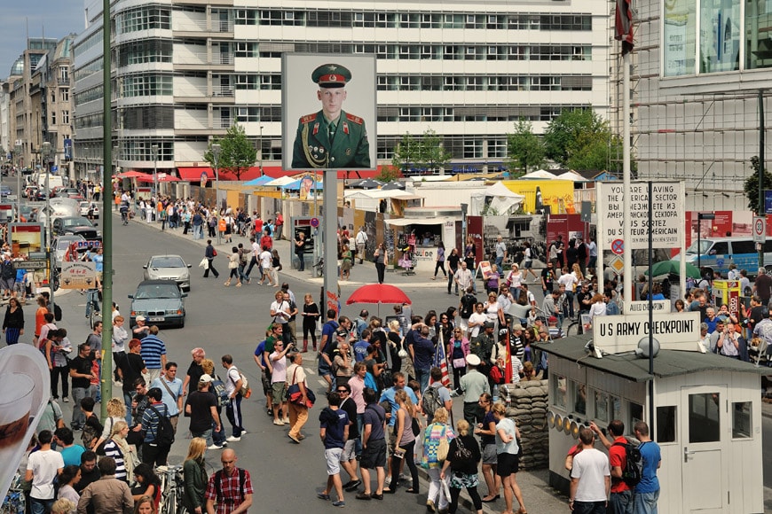
Checkpoint Charlie, Berlin; photo: Friedhelm Denkeler
Iron Curtain Trail / Green Belt, Europe
Today, the course of the former western border of the Warsaw Pact States is now the path of the Iron Curtain Trail cycle route. Stretching from the Barents Sea on the Norwegian-Russian border to the Black Sea on the Bulgarian-Turkish border, it runs for 10,000 kilometers through 20 countries, 15 of which are European Member States. It reminds us of the decades of continental division – but also of the predominantly peaceful revolutions in Central and Eastern Europe that led to its overcoming.
A visible memory of the historical events had already been created in the form of the “Berlin Wall Trail”, which has been marked and made suitable for cycling. Soon after the fall of the Wall, the German Cyclist’s Association (ADFC) and the Green Party in Berlin called for a cycle path along the former border. Their proposals initially fell on deaf ears as the mood of the media and most of the politicians at that time was that “The Wall must go!” After public and political pressure, the Berlin Senate and House of Representatives decided to protect the remains of the Wall and to expand and signpost the Berlin Wall bike path. After the Berliner politician Michael Cramer, who initiated the project, got elected into the European Parliament, he came up with the idea to designate the complete European course of the Iron Curtain as the Iron Curtain Trail.
The Trail passes through several national parks with interesting flora and fauna and connects numerous unique landscapes that previously lay in exclusion zones and had for decades developed as unspoiled nature. Along the route, one also encounters numerous memorials, monuments, and border museums as well as some of the remaining watchtowers that bear testimony to the division of Europe and its overcoming through peaceful revolution.
Along the route, the European Green Belt forms a corridor connecting National Parks, Nature Parks, and Biosphere Reserves. This 12,500-kilometer strip is one of the longest continuous biospheres and acts as a refuge for an astonishing amount of plant and animal species. Here, the geopolitical scar emblematically fuses by combining a culture of remembrance and nature conservancy.
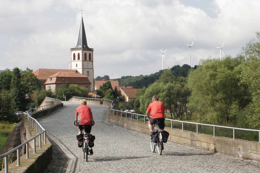
The Brücke der Einheit to Vacha, Photo: Jürgen Ritter (from: Deutsch-Deutscher Radweg, Michael Cramer)
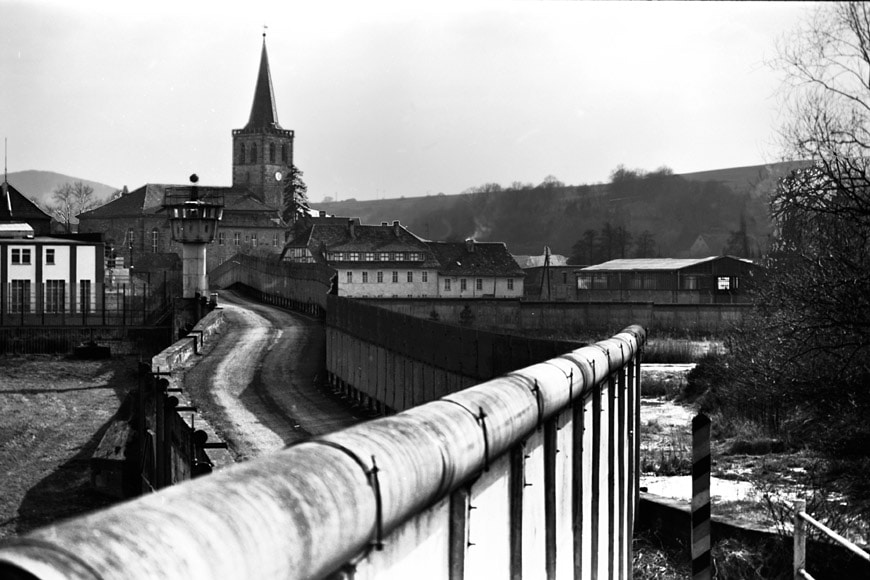
Vacha, 1986, Photo: Jürgen Ritter (from: Deutsch-Deutscher Radweg, Michael Cramer)

Spanning some 10.000 kilometers / 6,200 miles, the Iron Curtain bike trail runs from the Black Sea to the Polar Circle; image courtesy of the Iron Curtain Trail http://www.ironcurtaintrail.eu/
Deserted Villages: Jahrsau (Saxony-Anhalt) and Lankow (Mecklenburg-Vorpommern)
In 1953 and 1961, under the code name “Ungeziefer” (Operation Vermin) and “Kornblume” (Operation Cornflower, named after the weed), the Socialist Unity Party (SED) forcibly resettled over 11,000 people living in villages near the border, typically from one day to the next without notice or legal basis. Those affected were families classified as “not loyal to the party line” and “politically unreliable”. Sometimes denunciation by a neighbor, membership of the church, or under-fulfilled milk or grain quotas were reason enough to be removed. Several small villages with only a few dozen residents were almost entirely depopulated; sometimes only one family remained. Two examples of these are Jahrsau and Lankow.
Jahrsau in the state of Saxony-Anhalt was a village with a circular ring of farmhouses that had existed since the Middle Ages. After the last remaining family was forcibly resettled in 1961, the settlement was completely demolished. Nature has since reclaimed it. In 2003, a stretch of border fence and the site of the former village was declared a listed monument, an unusual step given that no physical remains still exist. The only testimonies to this serious violation of human rights are a small memorial stone, an information panel, and an entry sign marking the name of the village that is no longer there.
Lankow in the State of Mecklenburg-Vorpommern suffered a similar fate. Many families were forcibly resettled in 1952 and 1961 to other parts of the GDR, and the 28 remaining residents eventually agreed to resettlement in 1973. In 1976, the deserted village was also razed. All that remains today are a few foundations and a symbolic village sign.
Not everyone has since been able to return to their former villages and properties as many of the former private plots now lie in the Green Band nature reserve. As such, not all wrongful confiscations have been reversed by the Federal Government. More than fifty deserted villages are evidence of a continued lack of will in society to officially put right these wrongs and to reconstruct what was lost. Further factors, such as ongoing population decline in the rural areas of Saxony-Anhalt and Mecklenburg-Vorpommern, also contribute to the fact that villages that had existed for centuries are no longer.
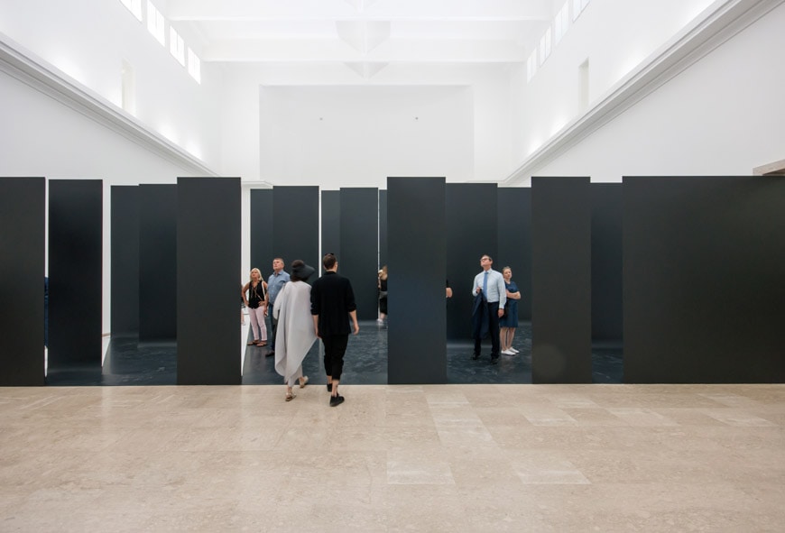
The German Pavilion at the 16th Venice Architecture Biennale – installation views

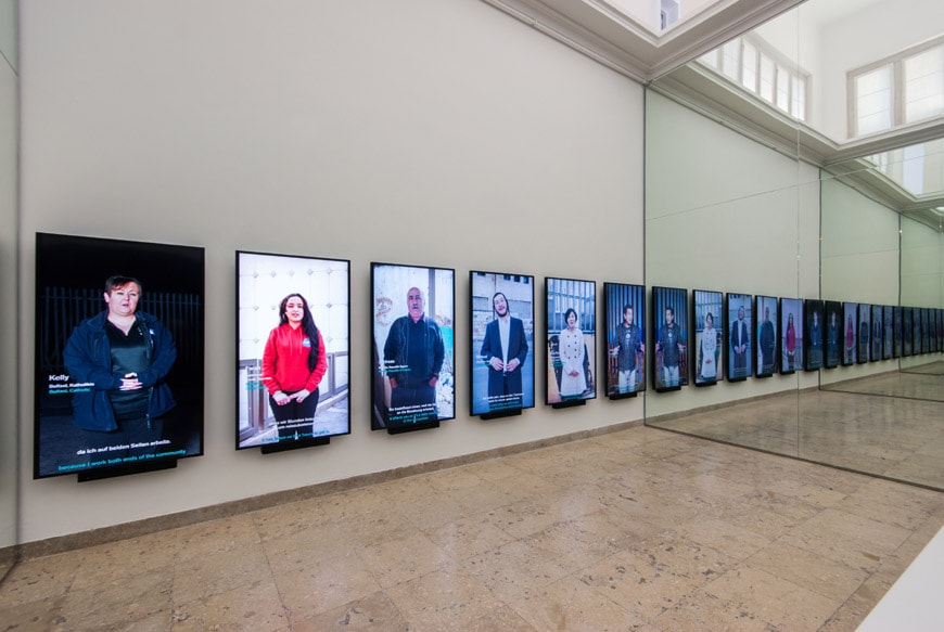
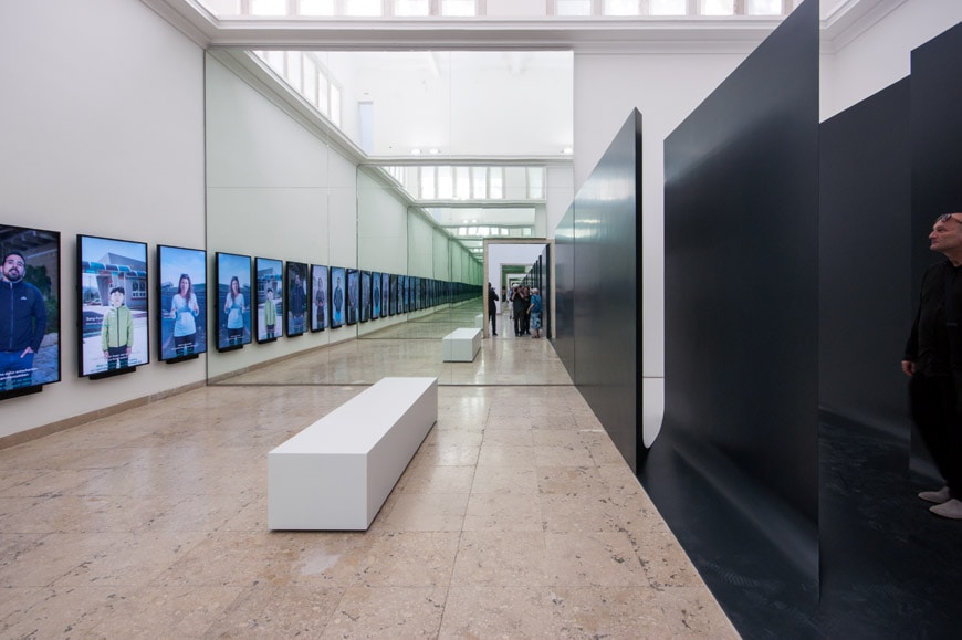
GRAFT, Unbuilding Walls” exhibition, German Pavilion, Venice Architecture Biennale 2018, installation views; photos © Inexhibit


copyright Inexhibit 2026 - ISSN: 2283-5474